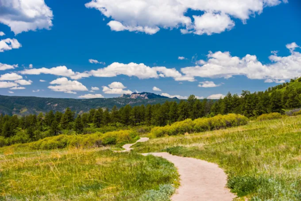
The Best Trails for Hiking and Running in Douglas County
For outdoor enthusiasts, one of the greatest perks of living in Douglas County is the unbeatable access to open space and scenic trails. With miles of paths winding through Castle Rock, Highlands Ranch, Lone Tree, Parker, Roxborough, and extending past the county into Denver, there’s something for every pace and experience level. Whether you’re a dedicated trail runner training for your next endurance run or simply planning a relaxed weekend hike, here are the top local trails worth exploring.

Trails 4 Miles and Under
Bluffs Regional Park and Trail
Difficulty: Difficult
Terrain: Soft surface trail
Start: Bluffs Regional Park, 10099 Crooked Stick Trail, Lone Tree 80124
Distance: 2.7 mile loop with one additional mile for outlook
Devil’s Head Lookout Tower
Difficulty: Difficult
Terrain: Unpaved
Start: 6500 S Rampart Range Rd, Sedalia, CO 80135
Distance: 1.4 miles one way
Good to Know: The trail gains 950 ft. in elevation gain and ends with a climb up 143 stairs. Dogs are not allowed on the stairs.
Metzler Family Open Space Parking and Trailhead
Difficulty: Easy to moderate
Terrain: Unpaved
Start: 838 E. Allen St., Castle Rock 80104
Distance: 4 miles
Mitchell Creek Open Space and Trail
Difficulty: Easy
Terrain: Paved
Start: Mitchell Gulch Park or East Founder Park lots
Distance: 3 miles
Pinery Loop Trail
Difficulty: Easy
Terrain: Soft and hard surface
Start: Bingham Lake Trailhead, 7740 Lakeshore Dr., Parker 80134
Distance: 4 miles
Rock Park
Difficulty: Difficult
Terrain: Unpaved
Start: 1470 Front St., Castle Rock 80104
Distance: 1.5 miles
Quarry Mesa Open Space and Trails
Difficulty: Moderate
Terrain: Unpaved
Start: 1701 Crystal Valley Parkway, Castle Rock 80104
Distance: 3.1 mile loop
Trails Over 4 Miles
Bayou Gulch Open Space and Two Bridges Trail
Difficulty: Moderate
Terrain: Soft surface trail
Start: 8038 Bayou Gulch Road, Franktown 80116
Distance: 10.4 miles with multiple loops
Backcountry Wilderness Area
Difficulty: Difficult
Terrain: Dirt path
Start: Wildcat Mountain – at Rocky Heights Middle School, Highlands Point – at Mountain Vista High School or 1170 Grigs Rd.
Distance: Wildcat Mountain – 5.5 miles, Highlands Point 10 miles, both connect to Douglas County East-West Trail
Good to Know: Dogs are not allowed on all the trails
Cherry Creek Trail
Difficulty: Easy
Terrain: Paved
Start: Multiple locations, trailhead at N. Pinery Road, Parker 80134
Distance: 42-miles in total, Douglas County maintains 11.3 miles of trail from Castlewood Canyon to Stroh Road
Daniels Park
Difficulty: Moderate
Terrain: Mostly dirt road with some asphalt and concrete sidewalk
Start: 8682 N. Daniels Park Rd, Sedalia 80135
Distance: 5.8 miles
Good to Know: Part of Denver Parks system, chance to see the protected bison herd
Dawson Butte Open Space and Trail
Difficulty: Moderate
Terrain: Dirt
Start: 1753 Tomah Rd., Castle Rock 80109
Distance: 7.7 miles, including 5 mile loop
Deer Creek Canyon
Difficulty: Difficult
Terrain: Single track trail
Start: Deer Creek Canyon Trailhead, 13388 Grizzly Dr., Littleton 80127
Distance: 14.5 miles
Good to Know: Managed by Jefferson County
Douglas County East West Regional Trail
Difficulty: Moderate
Terrain: Dirt path
Start: Ridgegate Trailhead, Bluffs Regional Park, Daniel’s Gate Park, Grigs Trailhead, Redtail Park, Pronghorn Park, Plum Valley Park, and Redstone Park
Distance: 27 miles one way
East Plum Creek Trail
Difficulty: Easy
Terrain: Paved
Start: Meadows Boulevard or Downtown Castle Rock
Distance: 8.6 miles
Hidden Mesa Open Space
Difficulty: Easy to moderate
Terrain: Natural surface
Start: 3217 North State Highway 83, Franktown 80116
Distance: 4.7 miles
Highline Canal Regional Trail
Difficulty: Easy
Terrain: Natural Surface
Start: Multiple Locations, trailhead at 11498 Roxborough Park Road, Littleton 80125
Distance: 71 miles total, Douglas County maintains the western 8 miles
Lost Canyon Ranch Open Space
Difficulty: Moderate to Difficult
Terrain: Natural Surface
Start: 6581 Lost Canyon Ranch Road, Castle Rock 80104
Distance: 10 miles of intersecting trails
Good to Know: No biking is allowed
Philip S. Miller Park
Difficulty: Moderate
Terrain: Unpaved and paved
Start: 1375 W. Plum Creek Parkway, Castle Rock 80109
Distance: 10.5 miles
Good to Know: Add to your workout on the 200-step incline at Challenge Hill
South Platte River Trail
Difficulty: Easy
Terrain: Dirt path or concrete sidewalk
Start: C470 Bikeway
Distance: 35 miles from Chatfield State Park to downtown Denver
Ridgeline Open Space and Trails
Difficulty: Medium
Terrain: Paved and unpaved
Start: 2525 Coachline Road, Castle Rock 80109
Distance: 13.5 miles
Sandstone Ranch
Difficulty: Moderate
Terrain: Natural surface
Start: 9605 S. Perry Park Road, Larkspur 80118
Distance: 12 miles
Sharptail Ridge Open Space and Trail
Difficulty: Moderate
Terrain: Natural surface
Start: 6500 Roxborough Park Road, Littleton 80126
Distance: 4.6 miles
Good to Know: Dogs are prohibited
Waterton Canyon
Difficulty: Easy
Terrain: Dirt road
Start: Waterton Canyon Trailhead
Distance: 13 miles out and back
Good to Know: Dogs are prohibited due to bighorn sheep
You May Also Like
Run Local: Douglas County Guide to the Best Organized Races
Tips for Starting and Sustaining a New Fitness Routine in the New Year